
GR® 655 - From Belgium to Santiago de Compostela
in Île-de-France


Fourth main pilgrim’s way, in France, « via Turonensis » lead pilgrims from northern Europe to Santiago de Compostela, passing through Tours, the city giving its name to the route.
This long distance footpath is waymarked with a white stripe above a red stripe..
Main stages

A long distance footpath (GR® 655) follows this route and goes through Ile-de-France from North to South.
In south of Paris, at Lozere station, the route splits into two branches :
- a west leg : through Chartres and the Loir valley
- an east leg: through Orléans and the Loire Valley
From Orry-la-Ville station to Paris (Saint James tower) :
|
out of GR® 655
From Orry-la-Ville station (SNCF, Paris Nord, RER D) to Commelles
ponds : 2 km
|
|
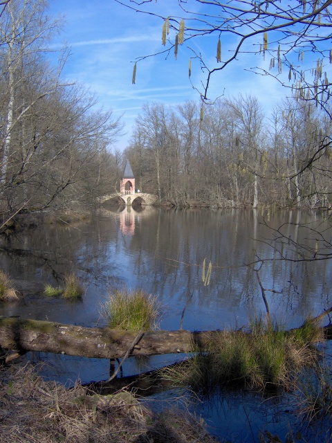
| From Commelles ponds to Royaumont abbey, via Coye and Baillon | 10 km |
| From Royaumont abbey to Viarmes (SNCF, Paris Nord) | 3 km |
| From Viarmes (SNCF, Paris Nord) to Seugy (SNCF, Paris Nord) | 2 km |
| From Seugy (SNCF, Paris Nord) to Luzarches (SNCF, Paris Nord) | 3 km |
| From Luzarches (SNCF, Paris Nord) to Bellefontaine | 6 km |
|
out of GR® 655 From Bellefontaine to Survilliers-Fosses station (RER D) : 5,5
km
|
|
| From Bellefontaine to Ecouen-Ezanville station (SNCF, Paris Nord), via Fontenay-en-Parisis and Le Mesnil-Aubry | 18 km |
| From Ecouen-Ezanville station (SNCF, Paris Nord) to Groslay station (SNCF, Paris Nord), via Piscop and Montmorency | 10 km |
| From Groslay station (SNCF, Paris Nord) to Saint-Denis (M13), via Pierrefitte and La Courneuve regional park | 14 km |
| From Saint-Denis (M13) to Paris (porte de la Villette) (M7), along the Saint-Denis canal | 6,5 km |
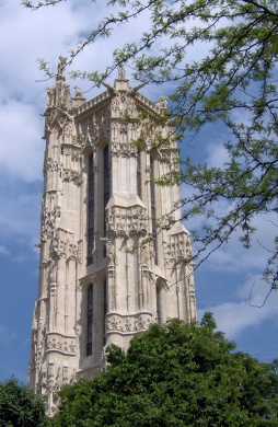
| From Paris (porte de la Villette) (M7) to Paris (Saint-James tower) (M1, M4, M7, M11, RER A, B, D) | 6 km |
From Paris (Saint-James tower) to Lozère station :
| From Paris (Saint-James tower) (M1, M4, M7, M11, RER A, B, D) to Paris (porte de Vanves) (M13, T3) | 6 km |
| From Paris (porte de Vanves) (M13, T3) to Chatillon-Montrouge station (M13) | 2,5 km |
| From Chatillon-Montrouge station (M13) to Fontenay-aux-Roses station (RER B), along the "coulée verte" | 3 km |
| From Fontenay-aux-Roses station (RER B) to Grande voie des Vignes street, along the "coulée verte" | 2,5 km |
|
out of GR® 655 :
From Grande voie des Vignes street to Bourg-la-Reine station
(RER B), through Sceaux park : 3 km
|
|
| From Grande voie des Vignes street to Igny station (RER C), along the "coulée verte" and through Verrières forest | 8 km |
| From Igny (RER C) to Lozère station (RER B), via Vauhallan | 7,5 km |


| From Lozère station (RER B) to Bures-sur-Yvette | 4 km |
|
out of GR® 655 : From Bures-sur-Yvette to Bures-sur-Yvette station (RER B) : 0,5
km
|
|
| From Bures-sur-Yvette (RER B) to Gif-sur-Yvette | 2,5 km |
|
out of GR® 655 : From Gif-sur-Yvette to Gif-sur-Yvette station (RER B) : 0,5
km
|
|
| From Gif-sur-Yvette to Courcelles-sur-Yvette station (RER B) | 4 km |
| From Courcelles-sur-Yvette station (RER B) to Saint-Rémy-les-Chevreuse station (RER B) | 2,5 km |
| From Saint-Rémy-les-Chevreuse station (RER B) to Saint-Arnoult-en-Yvelines, via Pecqueuse, Bonnelles, La Bâte and Longvilliers | 24,5 km |
| From Saint-Arnoult-en-Yvelines to Rambouillet (SNCF, Paris Montparnasse), through Rambouillet forest | 13 km |
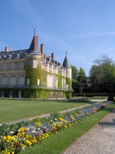
| From Rambouillet (SNCF, Paris Montparnasse) to Gazeran, through the park of Rambouillet castle | 6 km |
|
out of GR® 655 : From Gazeran to Gazeran station (SNCF, Paris Montparnasse) : 1
km
|
|
| From Gazeran to Epernon (SNCF, Paris Montparnasse), via Saint-Hilarion and Droue-sur-Drouette | 13 km |
Then, the GR® proceeds on its way in Eure et Loir.
| From Lozère station (RER B) to the foot-bridge upon the Yvette river | 2,5 km |
|
out of GR® 655 :
From the foot-bridge upon the Yvette river to Palaiseau-Villebon
station (RER B) : 1 km
|
|
| From the foot-bridge upon the Yvette river to the D 46 road, via Saulx-les-Chartreux and Longpont basilica | 11,5 km |
|
out of GR® 655 :
From the D 46 road to Saint-Michel-sur-Orge station (RER C) : 1
km
|
|
| From the D 46 road to Arpajon station (RER C) | 9,5 km |
| From Arpajon station (RER C) to the junction with the GR® 1 | 6 km |
|
out of GR® 655
From the junction with the GR® 1 to Breuillet-Village
station (RER C) : 3 km
|
|
| Common part with the GR® 1, via Saint-Sulpice de Favières and Torfou | 9 km |
|
out of GR® 655
(GR® 1) From the split with the GR® 1 to
Lardy station (RER C) : 2 km
|
|
| From the split with the GR® 1 to Etréchy | 12 km |
|
out of GR® 655 :
From Etréchy to Etréchy station (RER C) : 1 km
|
|
| From Etréchy to Etampes station (RER C), via Brières-les-Scellés | 9 km |
| From Etampes station to the foot-bridge upon the Chalouette river | 2 km |
|
out of GR® 655 :
From the foot-bridge upon the Chalouette river to Saint-Martin
d’Etampes station (RER C) : 0,2 km
|
|
| From the foot-bridge upon the Chalouette river to Boigneville (RER D), via Ormoy-la-Rivière, Mesnil-Girault, Puiselet-le-Marais, Valpuiseaux et Champmotteux | 32,5 km |
| From Boigneville to Malesherbes station (RER D), via Argeville et Touvaux | 8 km |
Then, the GR® proceeds on its way towards Pithiviers and Orléans.
Éditing-The guide of GR® 655
‘‘Sentiers vers Saint-Jacques-de-Compostelle'’
via Tours > Bruxelles - Paris - Tours
The GR® 655 trail, using the route of the old pilgrimage routes, is marked out by important stages: old abbeys, basilicas, like those of Saint-Quentin and Saint-Denis, famous cathedrals like those of Noyon, Senlis, Paris, Chartres, Orléans or Tours.
In the footsteps of pilgrims from the North, let's explore the territories along the Sambre or the Oise, through the Avesnois grove, the Picardy state forests, Île-de-France and Orléanais to join the "Valley of the Kings".


FFRandonnée Île-de-France
Hall i - BAL 16 - 67 rue Vergniaud - 75013 PARIS
- Accueil uniquement sur rendez-vous-
Tél : 01 48 01 81 51
Courriel : [email protected]
